1.32M km²
Smoke observed
Area where the satellites measured smoke, up 0.12 million km² from the day before.
The Bundle turns satellite data into a daily map that shows how confident each reading is and which areas were hidden by cloud.
Smoke covered 1.32 million km², and clouds hid 38% of the map.
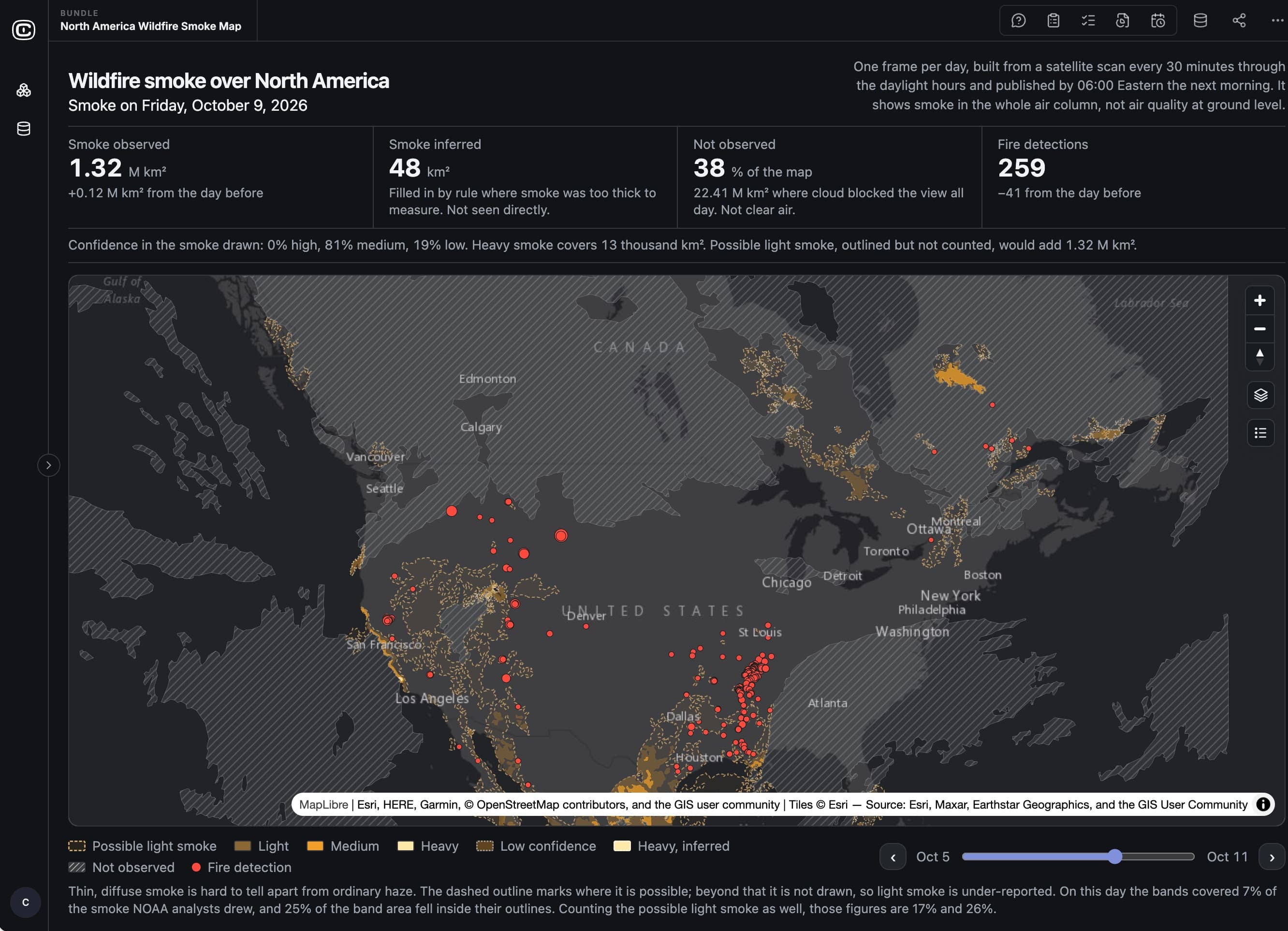
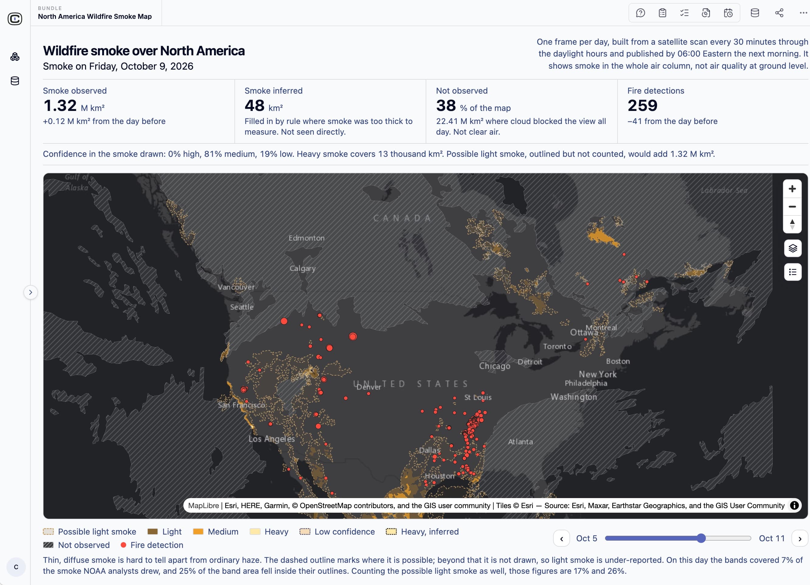
Each patch of smoke is rated high, medium, or low from three checks.
North America · one day’s map
Heavy smoke covered 13 thousand km². Possible light smoke, outlined but not counted, would have added another 1.32 million km².
Clairvoyint combines the satellite map with ground monitors, other satellites, and your own stations, and the next daily map uses them.
Examples use public, modeled, or fictional data. Results are research and are not investment, trading, betting, or operational advice or forecasts.